
Key Takeaways
- This wasn’t a filter, a wildfire, or a sunset. On March 27, 2026, Tropical Cyclone Narelle whipped iron-rich red dust from Western Australia’s ancient soil into the atmosphere, turning the sky over Shark Bay a deep blood-red in broad daylight. The effect lasted hours — not seconds.
- The science is genuinely fascinating, and you can use it. Rayleigh scattering explains why the sky is normally blue — but when large dust particles flood the atmosphere, they block shorter wavelengths and let red light dominate. This is the same reason Mars looks red. The physics of light doesn’t care how dramatic the situation is.
- Cloud cover was the secret ingredient. Under direct sun, dust storms turn the sky orange. The thick cloud from Narelle removed the single-direction light source, creating what one meteorologist called “a panel of lighting” — omnidirectional red. That’s a lighting condition no studio can replicate.
- Cyclone Narelle was historic, not just photogenic. It made landfall four times across Australia and was the first tropical system in more than 20 years to affect three states simultaneously — Western Australia, Queensland, and the Northern Territory. The red skies were striking, but the storm itself was serious.
- Your camera gear is not ready for this, and you should know that now. Most weather-sealed cameras don’t have certified IP ratings for dust. Fine iron-oxide particles are a different beast than rain. Knowing your gear’s actual ingress protection rating before you’re standing under a red sky could save you an expensive repair.
When the Sky Forgets the Rules
Imagine you’re standing outside the Shark Bay Caravan Park in Western Australia. It’s late morning. The air smells metallic, like a handful of old coins pressed against your face. Everything — every surface, every car, every leaf — is dusted in fine rust-red powder. You look up.
The sky is not orange. Not pink. Not any color you’d associate with a filter preset or a particularly dramatic sunset. It is red. Deep, apocalyptic, Mars-on-a-bad-day red. And it’s 10 a.m.
That’s exactly what happened on March 27, 2026, when Tropical Cyclone Narelle made landfall near the Gascoyne Coast of Western Australia with wind gusts reaching up to 195 km/h. The footage hit social media within hours and stopped the internet cold. PetaPixel covered it with footage from the Shark Bay Caravan Park — one of the first photography-focused outlets to document just how extraordinary the light conditions actually were. People who’d never been to Australia were asking if the clips were AI-generated. They weren’t.
Here’s the thing photographers need to understand: this was not an accident. Not chaos. Not just “weather being weird.” Every element of that red sky followed rules — rules of physics, geology, and atmospheric science that have been well understood for over 150 years. The only thing that broke the rules was how extreme the combination became.
Let’s break it down, because this event is basically a masterclass in how light behaves — and it has real implications for how you think about shooting in extreme conditions.
Why the The Sky Turned Blood Red in Australia (Stay With Me — It Gets Wilder)
Alright, quick science detour. I promise it pays off.
The sky is blue because of a phenomenon called Rayleigh scattering. When sunlight enters Earth’s atmosphere, it collides with tiny molecules — mostly nitrogen and oxygen. These molecules scatter light, but not evenly. They scatter short wavelengths (blue and violet light) far more aggressively than long wavelengths (red and orange light). So blue light bounces all over the sky in every direction, while red light mostly passes straight through to your eyes.
The wavelength dependence is significant — shorter blue wavelengths are scattered roughly 9.4 times more strongly than longer red wavelengths, according to the Royal Observatory Greenwich. That’s not a small difference. That’s why your noon sky is a vivid blue and not a muddy grey.
Now here’s where it flips.
At sunset, sunlight travels a much longer path through the atmosphere to reach your eyes. By the time it arrives, the blue light has been scattered away entirely — it never made it. What’s left? Red and orange. That’s your golden hour. Beautiful, reliable, expected.
But Narelle didn’t do golden hour. Narelle did something stranger.
Strong winds lifted iron-rich red soil and dust into the atmosphere, which, combined with scattered sunlight, filtered out most wavelengths except red. You’re not just getting red wavelengths surviving — you’re getting red dust particles actively absorbing and redirecting everything else. According to the UCAR Center for Science Education, when there are more particles in the atmosphere — especially larger ones like dust — more light is scattered and the colors are dramatically enhanced. Intense red conditions are often visible near wildfires and volcanic eruptions for the same reason.
The soil in Western Australia’s Gascoyne region has been oxidizing for millions of years. It’s essentially rust. When a cyclone lifts millions of tons of ancient rust into the air, the atmosphere becomes a red filter at a planetary scale.
The Cloud Cover Was the Plot Twist

Here’s what made the Shark Bay event visually unlike any other dust storm — and why photographers should care specifically about this detail.
Most dust storms happen under open sky. Direct sunlight still hits the particles from a single angle, which softens the effect. The dust looks orange-ish. Eerie, sure. But not like this.
Narelle came with a thick blanket of cloud cover. And that changed everything.
Senior Bureau of Meteorology forecaster Angus Hines told ABC: “When you have got the thick cloud cover, the light doesn’t feel like it’s coming from a single source. It feels like the light is evenly illuminating the ground, like a panel of lighting as opposed to one bright spotlight.” He called it “the most striking example of that phenomenon” he had ever seen.
Think about what that means photographically. Normally you’re chasing directional light — the angle, the shadow, the drama of one source. Here, the clouds diffused the light in every direction before it hit the dust layer. The result was omnidirectional red. No shadows. No gradients. Just a uniform crimson world.
Honestly? That’s a lighting setup that would cost a film studio tens of thousands of dollars to approximate. Narelle did it for free across an entire coastline. And nobody planned for it.
The Storm Behind the Shot: This Wasn’t Just Photogenic Weather
Let’s pause on the “wow, cool photos” angle for a second — because Narelle was a serious, historically significant storm and that context matters.
According to The Watchers, a meteorological reporting outlet that tracked Narelle closely, the system made landfall near the Gascoyne Coast on March 27 with gusts of up to 195 km/h, generated widespread dust storms across arid regions, and caused severe flooding and multiple rescues. Dr. Milton Speer, a fellow at the University of Technology Sydney and former Bureau of Meteorology forecaster, described Narelle as exceptional: “Such cyclones have been historically rare, but when they do occur, they tend to take a looping trajectory across Australia similar to Narelle’s path.”
The storm was the first tropical system in over 20 years to impact three Australian states — Western Australia, Queensland, and the Northern Territory. Comparable systems include Cyclone Ingrid from 2005 and Cyclone Steve from 2000. It made landfall four times before being downgraded to a subtropical low by Saturday.
The photos are stunning. They’re also documentation of a major disaster event. That tension matters. When photographers talk about “chasing” weather, there’s a real line between documenting the extraordinary and being reckless about it. The people at the Shark Bay Caravan Park weren’t standing outside for the shot — they were watching the sky change from what was hopefully a safe position before things got worse.
I’ll be blunt: if you ever find yourself in a situation like this, the image is not worth your safety or your equipment. Know when to shoot from inside. Know when to stop entirely.
What Narelle Tells Us About Shooting in Extreme Conditions
Here’s where this gets practically useful for photographers.
If you’d been in Shark Bay that morning with your camera, you would have faced two problems: the most extraordinary light of your career, and a fine-particle dust storm that could have destroyed your gear in minutes.
Most photographers assume “weather sealing” means they’re covered. It doesn’t. Not for this.
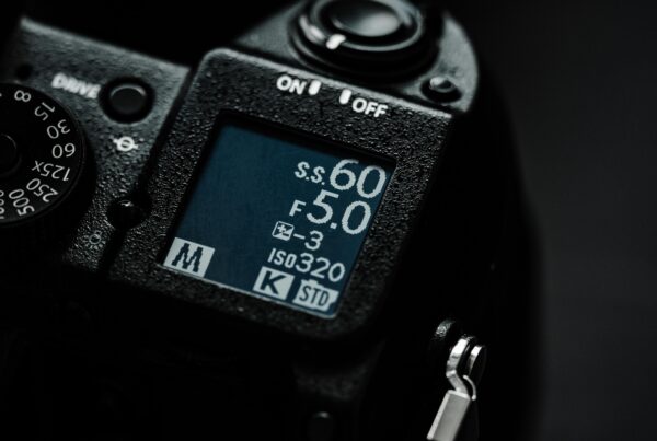
Most camera manufacturers don’t actually designate a formal IP (Ingress Protection) rating for their cameras. Canon, Nikon, Sony — they all describe their weather sealing as “dust and moisture resistant,” but without measurable IP certifications. As Digital Camera World found in their comprehensive weather sealing review, the only mirrorless camera manufacturer that currently publishes a certified IP rating is OM System, with its OM-1 Mark II and OM-5 carrying an IP53 rating — meaning dust-protected, but not dust-tight.
And this is exactly the kind of gap our piece on how cameras are finally being built for real-world conditions digs into — the difference between what manufacturers claim in marketing copy and what their specs actually guarantee when conditions go sideways.
The dust from Narelle wasn’t ordinary dust. It was fine iron-oxide particles, the kind that get into everything. Seams between body panels. The mount ring. The gap around your rear dial. For shooting in dry, sandy conditions like a cyclone-driven dust storm, IP54 is really the minimum floor for meaningful dust protection.
So what do you actually do? A few practical things:
Before you shoot in a dust storm:
- Use a rain cover or camera sleeve — not for water, but as a physical barrier against particle ingress
- Tape over any port covers and card slot doors you won’t need
- Bring a sealed plastic bag to store your camera if the storm intensifies
- Avoid changing lenses in the open air — every second the mount is exposed is a second dust has a path to your sensor
After you shoot in a dust storm:
- Brush the body down before opening anything
- Have the camera professionally cleaned sooner rather than later — iron particles are abrasive
- Check your rear element, viewfinder, and sensor readout for scratches before your next paid job
And honestly? Read your camera’s actual weather spec sheet. Not the marketing copy — the spec sheet. Find out what “weather sealed” actually means for your body. It’s less glamorous than assuming you’re bulletproof, but it’ll save you money.
The Mars Connection (Because This Gets Cooler)
One more thing, and it’s worth lingering on.
The sky on Mars turns red during dust storms for the exact same reason — strong winds lift iron-rich dust from the Martian surface into the thin atmosphere, where it scatters red light more efficiently than blue, producing an effect that’s actually the opposite of what we normally see on Earth. Mars’s sky is red by default, blue at its sunsets. Earth’s is the reverse. The same physics, flipped.
Western Australia’s Gascoyne region isn’t geologically identical to Mars, but the mechanism is remarkably similar. Ancient iron-oxide soil, powerful winds, airborne particles at scale. For a few hours on March 27th, Shark Bay looked more like the surface of another planet than a coastal tourist town.
And speaking of photography from extreme, otherworldly environments — if you haven’t read about the astronaut who fell in love with photography while living on the International Space Station, it’s a fascinating companion read. Light behaves differently the further you push it from normal conditions. That’s the through-line.
This is what extreme weather events actually teach us about light: it isn’t magic. It isn’t random. It follows physics with total, indifferent precision. And when the conditions stack — ancient geology, a historic cyclone, cloud diffusion, and the right angle of sunlight — physics creates something that no filter, no composite, no AI image generator has ever truly replicated.
Real photographers were there for it. Some of them probably ruined their gear getting the shots. Some of them probably got the shots of their lives.
The Shot You Can’t Plan For
Alright, here’s where I’ll get honest for a second.
Every photography curriculum, every YouTube channel, every paid workshop will teach you to control the light. Find the golden hour, scout the location, study the forecast, know the angle of the sun for every minute of the day. That’s good advice. Follow it.
But events like Narelle remind you that the most extraordinary light in the history of a place doesn’t care about your plans. It shows up on a Tuesday morning when the sky decides to go full Mad Max without sending a calendar invite.
The photographers who got the best images that day weren’t the ones with the most expensive weather-sealed bodies or the most elaborate shooting plans. They were the ones who understood what they were looking at — who knew enough about light and atmosphere to recognize that the world was giving them something unrepeatable — and who had enough presence of mind to point a camera at it.
That’s the deeper skill. Not the technical one. The one where you look up at a blood-red sky at 10 a.m. and your brain says: I know exactly what’s happening here, and I know exactly how to capture it.
Learn the science. Know the physics. Understand why the sky does what it does — on a good day, on a bad day, on a day that looks like the end of the world.
Because someday, the sky will go red, and you’ll want to be ready. And if you want to see how film photographers have been chasing the red palette on their own terms, the Harman Red 125 redscale film is a fascinating look at how analog shooters manufacture this color world deliberately — no cyclone required.
FAQ
Why did the sky turn red in Australia during Cyclone Narelle?
The red sky was caused by three factors working together at unusual intensity. First, Cyclone Narelle’s powerful winds — gusting up to 195 km/h — lifted enormous quantities of fine dust from Western Australia’s ancient, iron-rich soil into the atmosphere. That soil is essentially oxidized iron, the same compound that makes rust red. Second, those particles acted as a massive atmospheric filter, absorbing shorter wavelengths of light (blue and violet) and allowing only longer red wavelengths to reach the ground — a process closely related to Rayleigh scattering.
Third, and critically, thick cloud cover removed the single directional light source. Instead of one bright spotlight creating gradients and shadows, the diffuse cloud layer illuminated the dust-filled air from every direction, creating an even, deep red glow across the entire sky. Bureau of Meteorology forecaster Angus Hines described it as “the most striking example of that phenomenon” he had ever seen.
Is a red sky during a dust storm dangerous?
Yes, in several ways — and photographers should take this seriously. Fine iron-oxide particles at high concentration reduce visibility significantly, and inhaling them in quantity is harmful to respiratory health, particularly for people with asthma or other lung conditions. Emergency authorities in Western Australia urged residents to remain indoors during the storm.
Beyond personal safety, the same dust particles that create striking red skies can cause serious damage to camera equipment — fine abrasive particles can infiltrate weather-sealed bodies through gaps around dials, ports, and mount rings, scratching sensor elements and coating internal components. If you’re shooting in a dust event, use a physical barrier like a rain cover even if your camera is weather-sealed, and have the body professionally cleaned after the shoot. The image is never worth a medical emergency or a ruined sensor.
Can I photograph a red sky dust storm with a regular camera?
You can — but there are real risks to your gear that you need to manage deliberately. Most consumer and prosumer cameras describe themselves as “weather resistant” without publishing specific IP ratings for dust. Weather resistance typically means the body can handle light splashes and light dust; it does not mean the camera is sealed against fine iron-oxide particles driven by cyclone-force winds.
Practically speaking, use a rain sleeve or camera cover as a physical dust barrier, avoid changing lenses outdoors, tape any port covers you won’t need, and plan to have the camera cleaned professionally after the shoot. Check our breakdown of how cameras are actually built for real-world conditions in 2026 for a more detailed look at which bodies offer the most meaningful protection — and which ones are mostly marketing language.